I have been GPS-reliant for so long that I am well and truly map-inept. I should never be given the map under any circumstances. Waze is my friend forever when traveling. The only exception to this is trains in metro areas: I somehow am not awful at trains.
Unlike Machu Picchu, the Acropolis, Meteora, Japanese mountaintop temples, and backwater towns in Costa Rica, there is almost no cellular reception for a large swath of our trip north of San Francisco. We have no reception when we enter and leave most of the parks and towns. I have downloaded no maps. I am not ready. Sometimes, Waze shows us driving us into an abyss. Somehow we have not gotten horribly lost yet, perhaps because 1/101 really is the only road option you have for the duration of the trip from San Francisco to the Redwoods.
And thus begins our road trip north to Redwood National and State Parks!
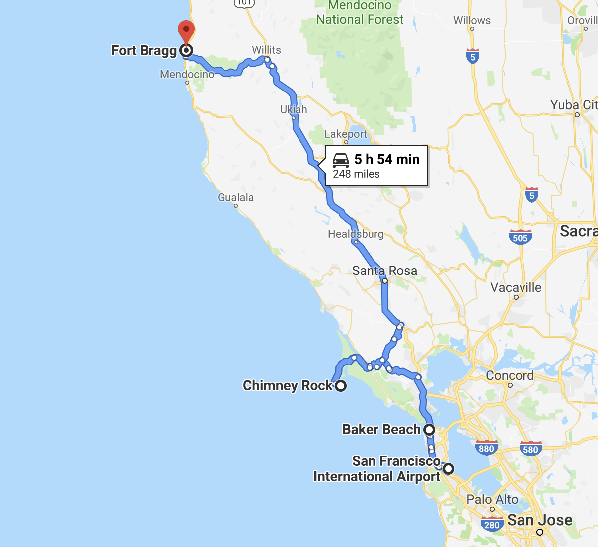
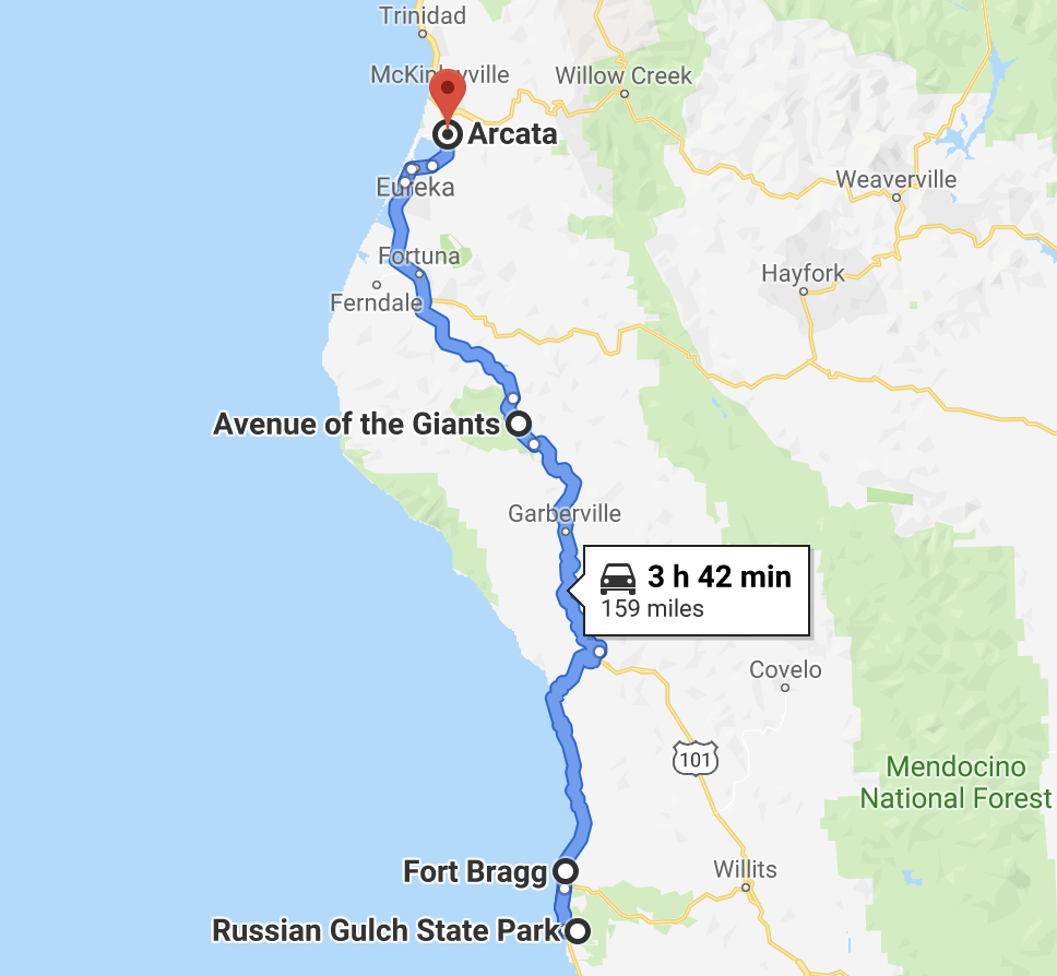
Our route the first day takes us to Fort Bragg, roughly halfway up to Eureka, with a few stops to see bridges, seals, cliffs, and birds along the way.
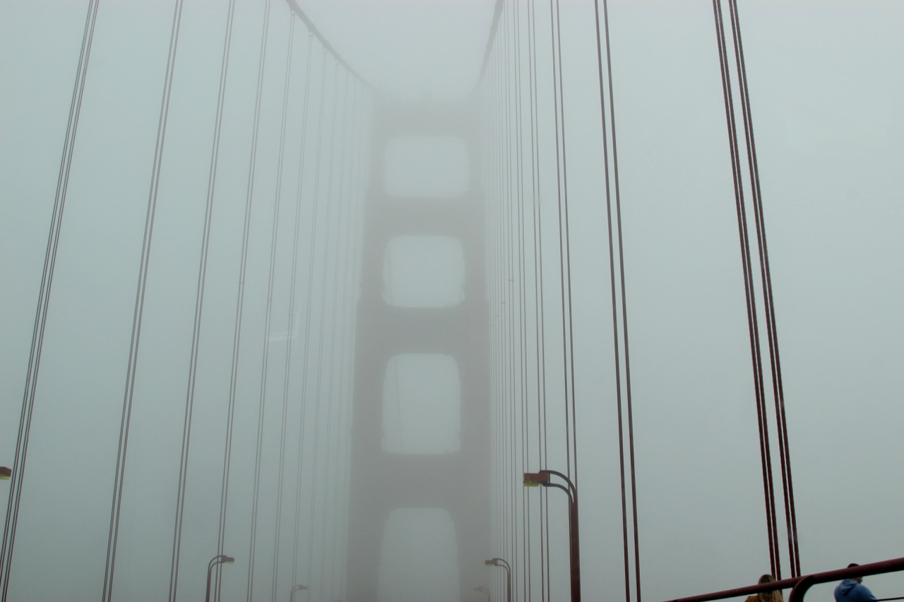
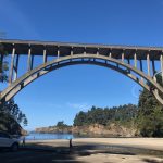
We left San Francisco mid-morning, hoping to see Golden Gate Bridge from Baker Beach. Alas, it was drizzly and foggy, so we only got to see beach doggos and an imaginary bridge.
In fact, it was so foggy we could barely make out the bridge as we drove across it. Lovecraftian spooky bridge is at least some bridge…
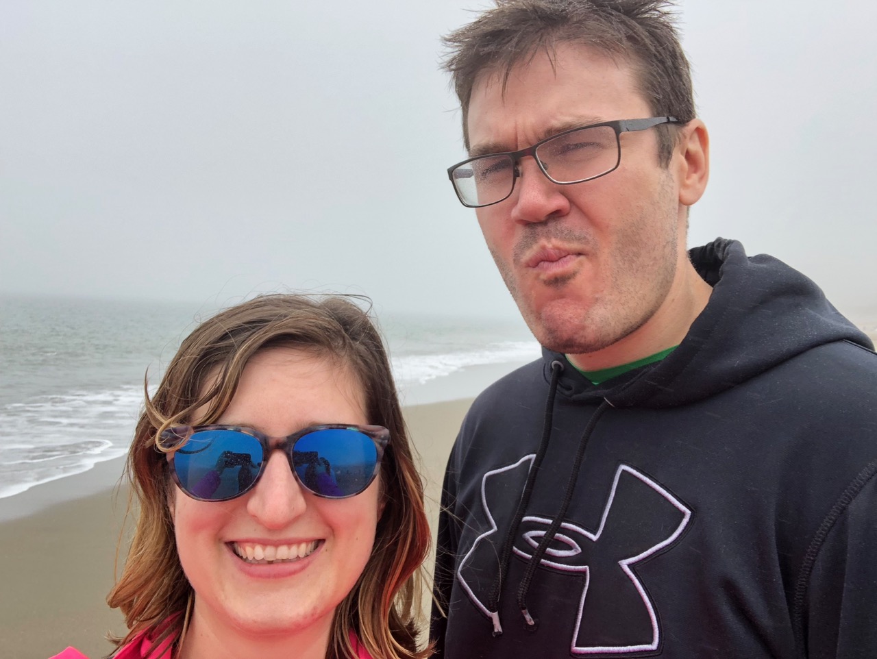
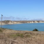
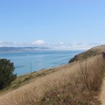
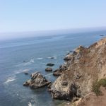
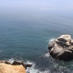
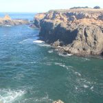
Our first stop on our road north was Point Reyes National Seashore, which was my Muir Woods backup choice – by the time I had gotten around to looking at parking reservations, they were full for morning parking slots. Muir Woods also is decidedly lacking in Elephant Seals, which Point Reyes had a-plenty. Seals don’t like the woods, I guess.
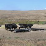
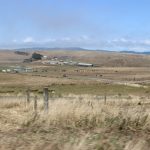
Point Reyes was 45 minutes north. It has some beaches and hiking, but we were only there to see the seals with the limited time we had. To get to the seals, we had to first drive through an endless sea of cows. Cows everywhere! There are numerous historic ranches within the state park, punctuated by basins, rivers, tourists, and trails. Cows: the seals of the land?
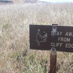
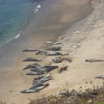
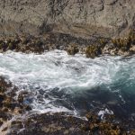
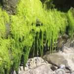
The clifftops are very dramatic, and we hiked between tickly long grasses and succulent bushes while waves pounded the cliffs and Elephant Seals made their weird burpy sounds from the beaches. Their calls echo off the cliff and sound like someone threw a heavy rock into a deep pool of water, or like a really burbly fart (think food poisoning) (you’re welcome).
At the end of our hike, we found a small group of seals snoozing on a sandy beach far below us, some of them corpulently flopping in the sand from time to time. They were the happiest napping creatures.
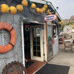
Our destination for the evening was Fort Bragg, just north of Mendocino. Point Reyes was our first signal failure – it took us about 20 minutes of backtracking until we had enough signal to point us back to the highway and onward to Mendocino. My favorite part was when all of our phones said they had data, but did not, and no maps could load.
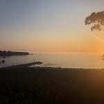
Our hotel was on a cliff overlooking the entrance of the harbor, and the sunset did not disappoint. We stopped for fish & chips in the old harbor. The only vegetarian option was grilled cheese on a bun, which was just two hamburger buns grilled with a bunch of cheese in them. Decidedly the most hilarious thing I’ve ever eaten, but I failed to take a picture.
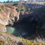
We left the next day for Arcata, our home for the rest of the week just south of Redwood National Park. On but slightly out of our way, we backtracked to Russian Gulch State Park for some coastal hiking before having to sit in the car for eons.
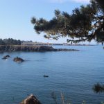
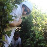
If you have time, you can hike in to see a waterfall along a ferny canyon, as advertised by a parking lot druid we met near the headlands trail. We didn’t have a half day, but we did have an hour or two to explore the clifftop trail, sinkhole, and bridge. It was worth the minor detour.
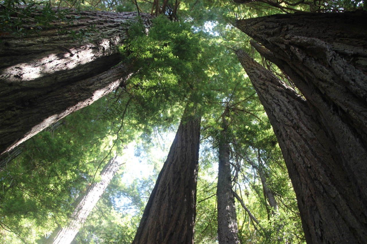
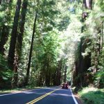
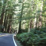
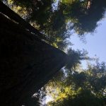
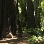
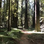
Like clockwork, our phones forgot how to data on the way out, and it took a good ten miles up the highway until we had any idea how long it would be until we arrived at our next stop. Two hours later, we arrived at the Avenue of the Giants, a 32-mile stretch of scenic highway that winds in and out of Humboldt Redwood State Park. It’s filled with tourists and pokey cars, and most importantly, lots and lots of redwood trees.
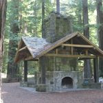
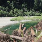
We stopped at the Women’s Club Grove, which had a little stone fireplace and a trail down to a gently-flowing river for swimming.
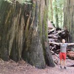
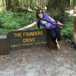
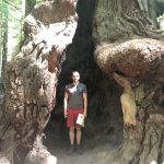
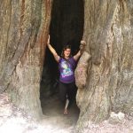
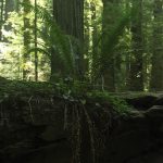
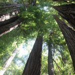
Our last stop was Founder’s Grove, which was a small hiking loop through some new growth redwoods. 95% of the redwoods were cut down during the logging rush in the 1800s, and Humboldt Park has “younger” redwoods, which are only a thousand years old.
Founders Grove features the huge Founder’s tree, but the thing we found the most impressive was the fallen redwoods toward the back of the loop. The innermost core of the tree remains strong and straight, and the rest peeled away kind of like string cheese. Fallen Redwoods: they are string cheese. Million-pound string cheese.
The Founder’s Grove was a wonderful short hike along the Avenue of the Giants – definitely worth the stop we made.

We finished our brief hike and piled back into Bertrudence (our faithful white Ford Escape) to our Air B&B in Arcata. Tomorrow is our first expedition into Redwood National Park!