There are two songs from Animaniacs which have stuck with me over the years: Yakko’s Nations of the World and Lake Titicaca.
The Animaniacs hit it right on the head in their song about this lake. Why do we sing of its fame? Because we really like saying its name!
This song stayed in my head all day and refused to leave.
Today was our guided tour of Isla Taquile and a floating reed island in the Uros islands cluster. I try to avoid guided tours as a general rule unless the destination is hard to get to or requires a string of complicated, non-online bookings where I will have to use google translate to communicate. Touring the islands of Titicaca fell squarely into the “too much of a pain to do by myself” category…and we weren’t disappointed with our guided tour!
We went with Edgar Adventures’ Titicaca Uncovered tour. It had good reviews on Trip Advisor, said it would avoid most crowds, and was lauded by our guidebooks as supporting the little communities who live on Lake Titicaca.
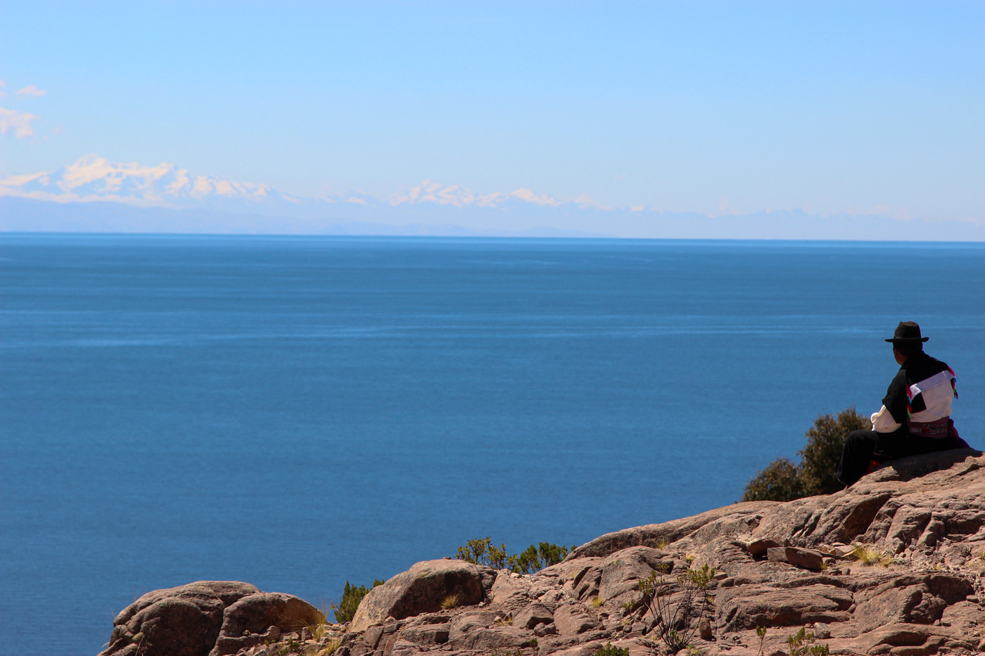
Isla Taquile
A bus picked us up and dropped us off at the port, where we met with the other members of our group. It was about 30 degrees this morning and the covered boat was a welcome sight – winds on the lake would be brisk.
Our guide, Percy, introduced himself and taught us about the lake and the communities which rely on it to survive.
First, we had to learn how to say Titicaca properly. Say it the way it looks and it means exactly what you think it means (and according to Percy, the caca part was Bolivia’s. Peru got the titi). The c in Titicaca is a harder sound which is slightly aspirated, similar to the Korean kk. Pronunciation is closer to Titikhakha.
There is a significant amount of illicit trade on the lake between Bolivia and Peru and the black market has a presence in Puno. I’m not sure what else is traded beyond gas, but gas is significantly cheaper in Bolivia and it’s one of the items which are ferried across the lake.
The water in Puno – tea water for drinking, water for showering, water for cooking – comes from the lake. Oh. So…you’re saying that coca doesn’t taste slightly fishy, it’s the water? Everything makes so much more sense now…
After about an hour on board, we arrived at Isla Taquile, the largest island on the lake. Long and covered in pre-Inca terraces still in use today, this hilly island has been inhabited for thousands of years. Thousand-year-old ruins dot the island hilltops and you can see straight across to the snow-capped peaks of the Cordillera Real in Bolivia or back over to Puno.


It was once used as a prison island by the Spanish for political criminals. Now, the land has been given back to the people of Taquile. They farm and produce wonderful textiles and were incredibly friendly.

In order to meet the local people, we had to walk up a few hundred feet. We huffed and puffed up the hillside, stopping to take pictures which was an excellent cover for the fact that even the tiniest hills would have us stopping to catch our breath after just a few minutes of walking.

We reached the top of the island (stopping to take pictures, not to catch our breath, of course), and then went down to the little Taquileño village on the Peru-facing side. The homes were made of brick, with tin or straw roofs, and many of them had solar panels. A few even had Direct TV satellite dishes on top of them!
Status in Taquileño society is determined by what you wear. The communities elect leaders, who must be a married couple. They lead the community together and wear black and red. Unmarried men wear floppy white and red stocking caps, and unmarried women have big colorful pom poms dangling from the ends of their clothing.

On the island, boys and men knit when they are not tending the fields. To officially become a man, a boy at the age of 15 must make his own hat. If it’s not high quality, he probably won’t find a girl to marry him when he turns 18 😉

After meeting the community, we headed back down to an empty beach where our boat awaited to whisk us off to lunch.


Lunch on the peninsula
Our lunch was prepared on the peninsula to the north of Puno city (Llachon?). It had been cooking in an earthen stove for most of the morning and the cooking women had to remove all of the hot rocks to get at our food. We were taught how to give thanks to pechamama (mother earth) and then we dug in (literally!). It was simple but pretty tasty.

Floating Reed Islands
Our next and final stop was at a floating reed island in the Uros cluster. The islands are entirely man-made from the reeds that float in the lakes.
Walking on it was like walking on a crunchy bouncy house, and it bobbed up and down as waves came in. The islands are anchored to the lake bottom, but in the event of a large storm, can be de-anchored and relocated to another part of the lake.
They were originally created for the peaceful Uros people to escape the invading Inca. If more dangers arose, they could simply raise anchor and float away from their invaders.

Each island foundation is made of reed roots tied together. The roots float up at the end of the rainy season in April. Once they are lashed together, they are submerged in water for six months after they are tied up so the roots on each of the floating bricks can grow together. Then, the islanders pile over a meter of reeds on top of the blocks. They continually stack reeds on top of reeds and move the houses around as the island needs to get thicker. The thicker the island, the older it is.

The kids on the island were friendly and the islanders seemed happy to see us. They sang us a few songs and we played with their kids.


Percy told us that the simple floating island life is losing its allure and many of the teenagers have been moving back to the mainland. The lake is becoming overfished and it’s hard to sustain communities. The culture is at risk of disappearing if current trends continue.
After saying goodbye to our new friends, we went back to our now incredibly warm boat and headed back to the mainland.
Tonight is our last night in Puno – tomorrow, we’re taking the Andean Explorer to Cuzco 🙂